Scotland Travel Blog March 2023
”Avoiding Crowds on Skye”
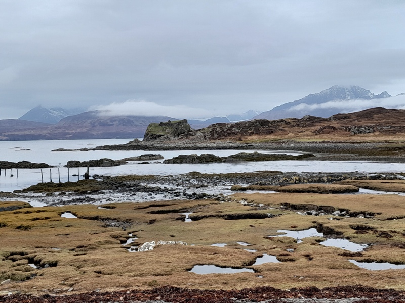
March isn’t my favourite month for touring Scotland as the weather is unpredictable and it’s pre-tourist season, so you often find that cafes in the Highlands aren’t open to give you a refuge from the rain (see our tips about visiting Scotland in Winter). But regardless of the weather, we needed to go back to Skye to check out some new B&Bs for the guides.
In recent years, March has been the month that I use for my visits to Skye. The advantage of going to Skye in March is the fact that you can get around the island without much traffic on the roads.
To put things into perspective. The population of Skye is around 13,000, but the island gets something like 650,000 visitors each year. And most of them arrive between July and August.
In 2006, when we first started Secret Scotland, it was possible to go to famous places like the Fairy Glen and have it all to yourself. The picture of the Fairy Glen below was taken by me on 11 August 2006 with not a soul in sight, unless you count the sheep.
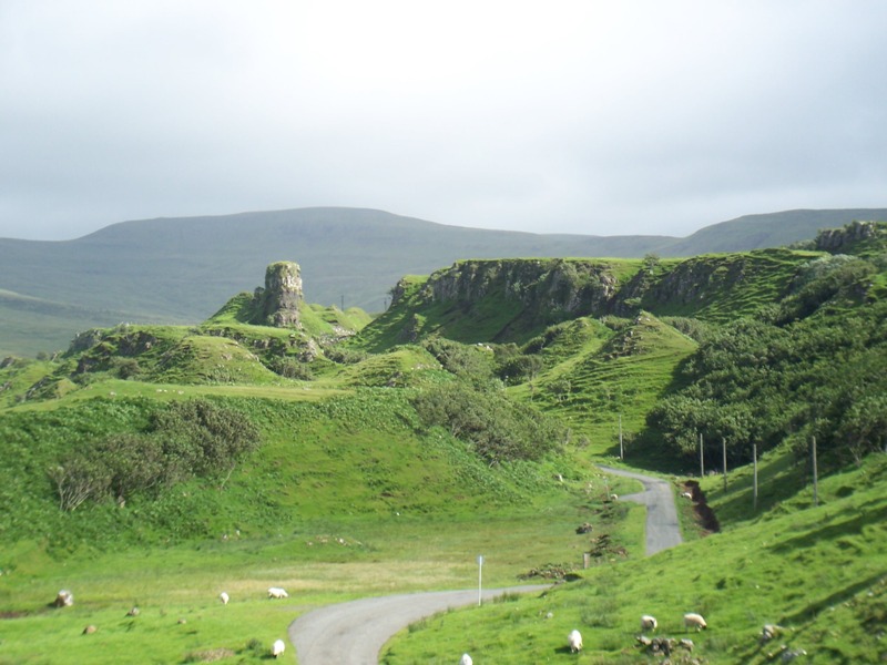
Nowadays, the area in the bottom left corner of the picture has a car park on it and the sheep have been replaced by tourists. Joni Mitchell’s lyrics come to mind, “They paved paradise and put up a parking lot”.
On Skye, if you don’t like crowds, you need to schedule your time so you visit the popular places out of season, or early/late enough in the day that you avoid the swarm. This rule especially applies to the following hot spots:
- The Fairy Pools (by the way, there’s no local folklore about fairies here)
- Neist Point Lighthouse
- Coral Beach near Dunvegan
- The Fairy Glen
- Quiraing
- Old Man of Storr
But there are still some places on Skye that aren’t on the mainstream tourist trail. Here are a few of the places that we recently visited that we had all to ourselves, but remember this was in mid-March.
Bearreraig Bay
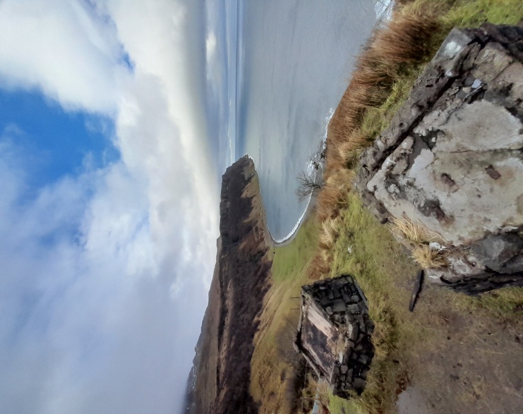
Bearreraig Bay is just south of the Kilt Rock / Mealt Falls and is very close to the car park for the Old Man of Storr, which is always a busy spot. Bearreraig Bay, on the other hand, will almost certainly be empty as the steep path down to the shore puts most folk off.
You can start the walk from the Old Man of Storr car park (which is pay & display), but we suggest that you try to get parked near the start of the private road that leads to Loch Leathan Dam. Please don’t block this road as people live at the end of it.
The appeal of Bearreraig is a waterfall that tumbles from an overhanging cliff. If you don’t mind a bit of a scramble, you can climb up to a ledge that passes between the waterfall and the cliff face, but it’s a bit perilous and not something we recommend you try.
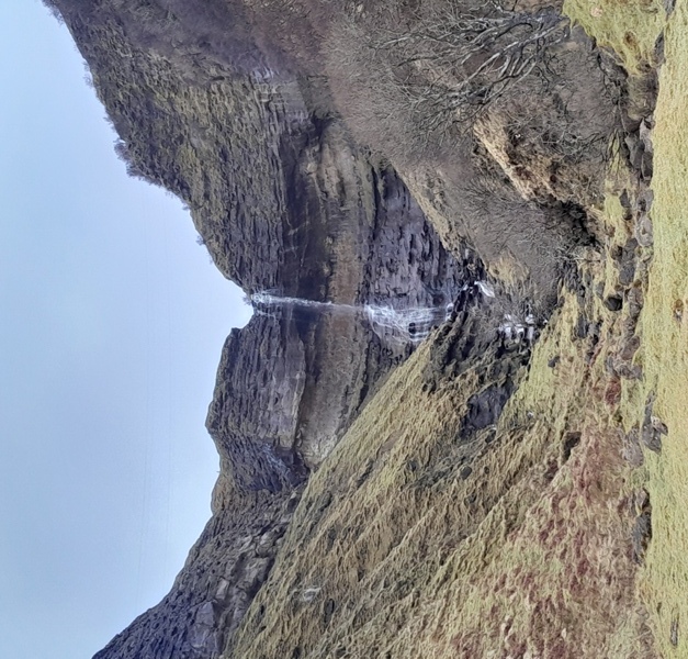
The cliffs around the bay are full of fossils, but you need to know what you are looking for. You won’t find any Brontosaurus skulls or thigh bones here, but you may see some ammonites.
If you do find a fossil in the cliffs, leave it where you find it. Removal of fossils from the cliffs is forbidden and could result in a fine.
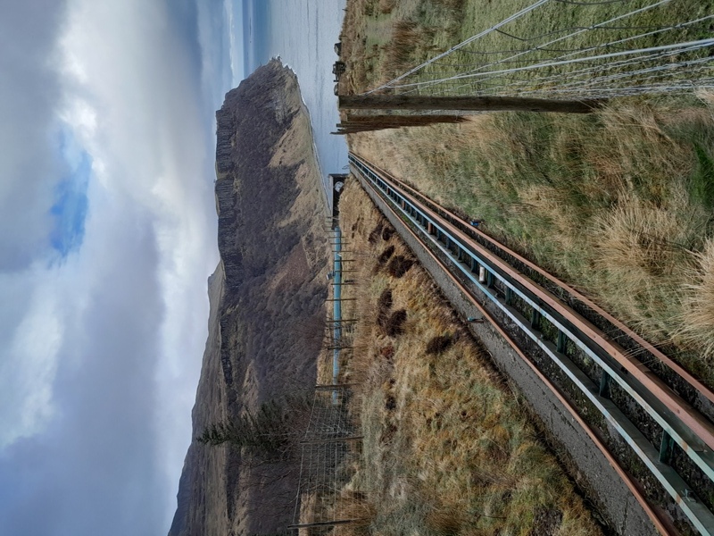
Bearreraig also has the unusual feature of a small funicular railway which was built in the 1950s to assist with the construction and maintenance of a small Hydro Electric power station which still operates. This power station provided the inhabitants of Skye with their first source of mains electricity. Prior to the Bearreraig hydro electric scheme, the only electricity on the island came from a few privately owned diesel generators.
But the thing that impressed us most at Bearreraig was the power of the tide crashing on the shingle shore. As the waves recede, they generate a powerful undercurrent that sucks out stones with a rumbling sound like thunder (I tried to capture this in the video below, but it doesn't convey how loud it is in real-life). It’s really quite awesome and explains why they couldn’t use boats to land materials for the power station.
The path to Bearreraig Bay isn’t muddy, but the descent alongside the funicular railway is very steep and quite tricky. You need to be quite nimble-footed and you can expect to have at least one slip on the way down. Going uphill is a bit easier, but the gradient will get your heart pumping. For the walk, we’d suggest you allow ~1.5 hours, a bit more if you aren’t as fit as you used to be..
Point of Sleat / Camas Daraich Beach:
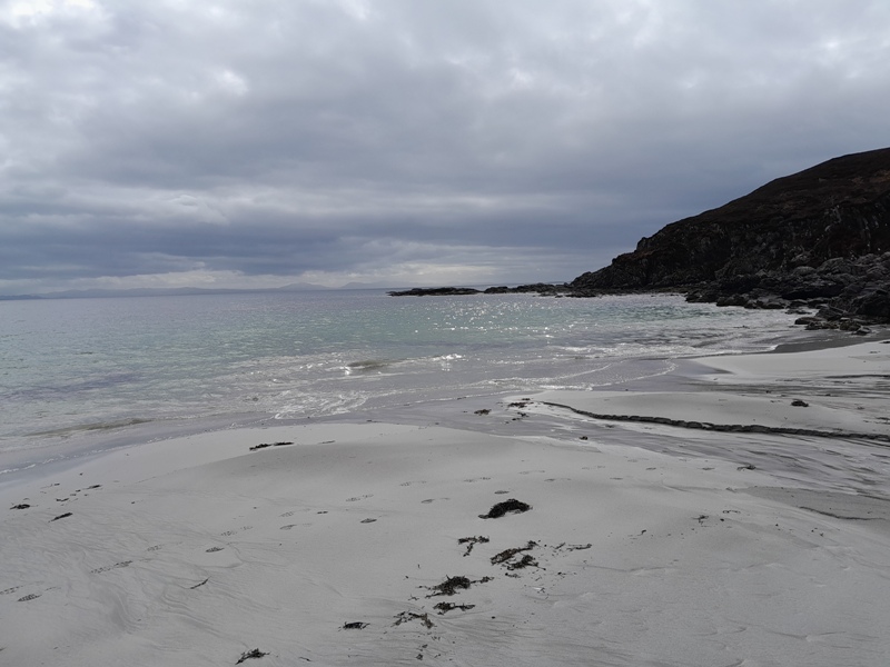
The Point of Sleat (pronounced “slate”) isn’t such a secret spot anymore, and the people who live nearby tell me that the car park is already getting overcrowded in summer. It seems that road rage in the car park is not uncommon as people get blocked in.
However, the car park is at the very end of a narrow little road at the very southern tip of Skye. So, it’s not a place that everyone will consider, and it was certainly quiet when we visited this March.
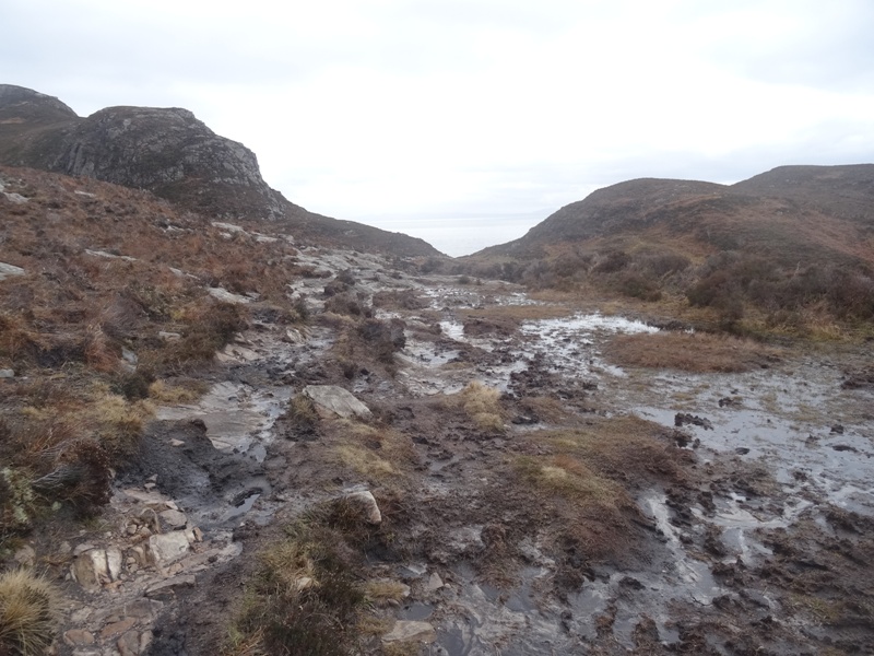
There are a few croft houses near the southernmost tip of Skye which fortunately means that most of the walk is on a good farm track that is easy to follow (just watch out for the cow pats). However, the last part of the walk to Camas Daraich beach, and then onto the wee lighthouse at Point of Sleat, is very muddy in places and you will need waterproof boots.
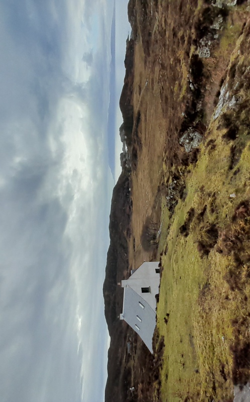
Away from the farm track, the path is suffering from too much traffic. As the path gets muddier, walkers are swerving wider and wider, so the ground is getting churned up into a swamp. It’s going to need a proper path built soon, but who will pay for that?
The attraction of Camas Daraich is a sheltered little beach that looks across the sea to Mallaig and Arisaig. It’s one of the few sandy beaches on Skye, but it is quite a small beach so you wouldn’t want to share it with too many other people. In all honesty, there are a lot of beaches around Arisaig that are far better.
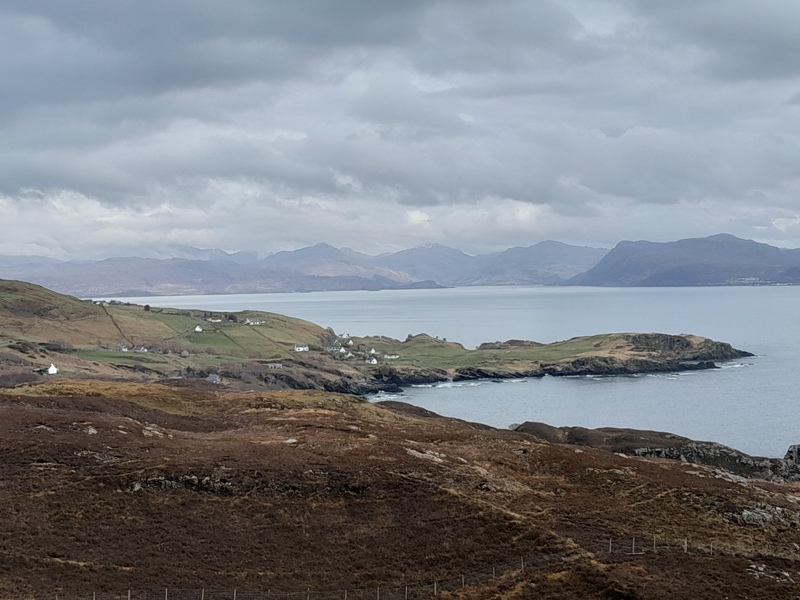
The things we enjoyed most about this hike, were the views looking east towards Knoydart and west towards the island of Eigg. We also really like the little Art Gallery in the Old Church of Aird, which is just beside the car park. This gallery displays the artwork of Peter and Heather McDermott. We thought the prices of their prints were very fair and we now have several of their pictures hanging in our house.
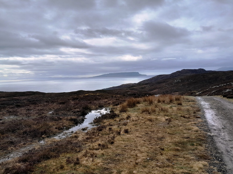
Allow 2 - 2.5 hrs for the hike out to the beach and a picnic. You can continue on from the beach to the little automated lighthouse at the southern tip of Skye, but the path gets muddier on this section and it adds another 30 - 40 mins to the hike.
Dun Scaith (Dun Sgathaich):
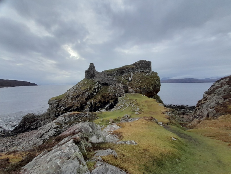
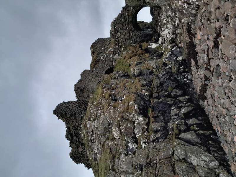
Dun Scaith (pronounced almost like “sky”) is a ruined castle on a coastal outcrop that would have made it a daunting place to attack. The name Dun Scaith translates from Gaelic as “Fort of the Shadow” which is a very cool name for any castle.
To go with the cool name, the castle has a cool legend that could make the basis of a great action movie. Way back in the mists of time, Dun Scaith was the fortress home of a feisty lady called Sgàthaich who was a master of the martial arts, a Scottish “Sensei” if you like. But if you wished to be tutored by Sgàthaich, you first had to prove your worthiness by penetrating the defences of the formidable Dun Scaith. According to folklore, these defences included several tiers of defensive walls, iron spikes, and a pit of snakes.
Sgàthaich’s most famous student was the Irish warrior Cuchulainn. He was a fierce warrior, but he was also a “bit of a Lad”, and folklore has it that he bedded Sgàthaich, her daughter, and her estranged sister. But then again, these were fearsome warrior women so he maybe didn’t have much choice.
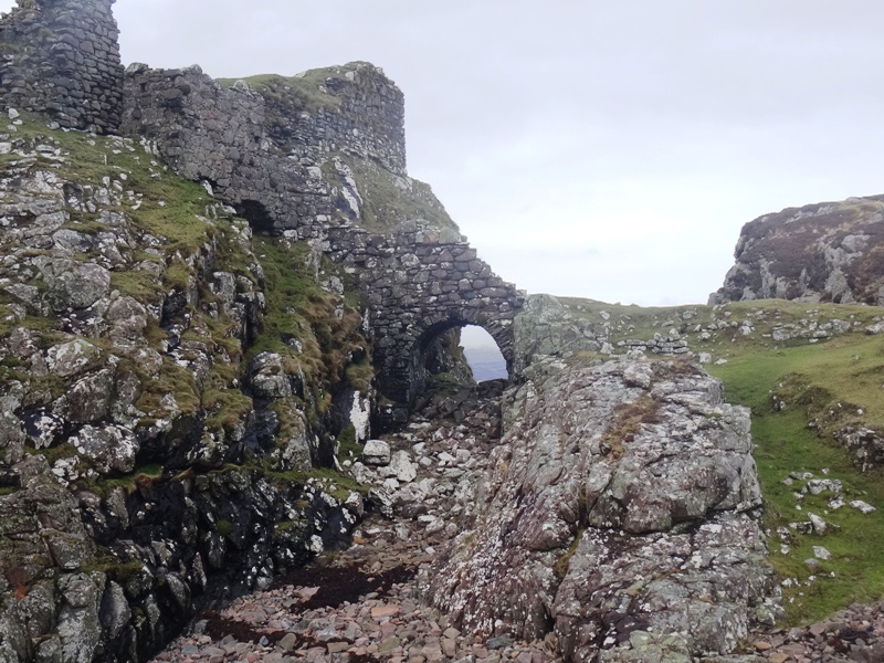
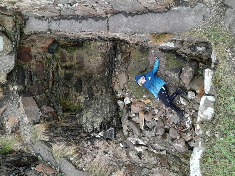
Not much of the castle remains, but it has the interesting feature of a drawbridge entranceway. The drawbridge allowed access over the narrow chasm that separates the castle rock from the adjacent headland. Whilst the wooden drawbridge is long gone, there still remain the two walls that would have flanked its sides and boxed in any would-be attackers.
If the enemy managed to get past the drawbridge, they then had to fight their way up a staircase which I’m sure the defenders would have designed to be a “killing zone”. If you’re bold, you can cross to the castle by shuffling along the narrow ledges that the drawbridge rested on. However, it’s not worth the risk as there’s not a great deal to see inside the castle other than the foundations of the outer walls.
Dun Scaith is on the north coast of the Sleat Penisula and could be combined with a visit to the Point of Sleat and Armadale Castle. If you are looking on a map, you will find the castle is just a little bit to the west of the scattered community of Tokavaig. The road to Tokavaig is a twisty single track with some steep gradients, so not a road for campervans.
The path to the castle starts near a cattle grid and the route is quite obvious, but there are some wet and muddy sections that are difficult to avoid. There is no official car park, but the roadside has some wide flat verges where 2 or 3 cars could park. Allow 30 - 45 minutes for the walk to the castle and some time exploring around it.
